
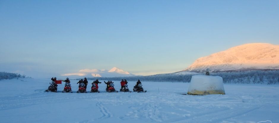
Imagine visiting three countries in less than 30 seconds… it can be done! On our Snowmobile Voyager holiday, you can zip around the northernmost international tripoint in the world.
A cairn sits in a river feeding lake Goldajarvi, which freezes over in winter. It marks the convergence of the borders of Norway, Sweden and Finland.
Here are some other things you should know about this iconic landmark that make visiting it even more memorable.
What is its name?
In English the tripoint is known simply as the ‘Three-Country Cairn’. The northern Sami, who are the indigenous people of Lapland, call it ‘Golmma Rikka Urna’. In Finland the cairn is named ‘Kolmen Valtakunnan Rajapyykki’, while in Sweden it goes by ‘Treiksroset’, and in Norway it’s ‘Treriksroysa’.
The history of the cairn
The Stromstad Treaty of 1751 laid down the border between Sweden and Norway. Cairns were raised in the years that followed to mark it, with #294 situated on a hill near Goldajärvi.
Sweden essentially controlled Finland until 1809, when it became an autonomous part of the Russian Empire. For most of the 1800s the tripoint had no marker, but in 1897 Norway and Russia erected a monument of stones along one of the rivers that crossed the Norwegian border.
In 1901, Sweden came to an agreement with Norway and placed a stone which identified it as the country’s most northerly point.
_w=1240_h=500_pjpg.jpg?v=202509161525)
The making a marker
Although cement was added to the rockpile shortly after the three-country tripoint was agreed upon, weather quickly wore away at it.
In 1926, a dome-shaped cairn made of concrete was poured on a bit of land jutting out into lake Goldajarvi. Located at 489 metres above sea level, the Three-Country Cairn has a diameter of approximately 4 metres. The upper part above water was painted yellow and ‘Suomi 1926’ was engraved on the top stone. ‘Suomi’ is the Finnish name for Finland.
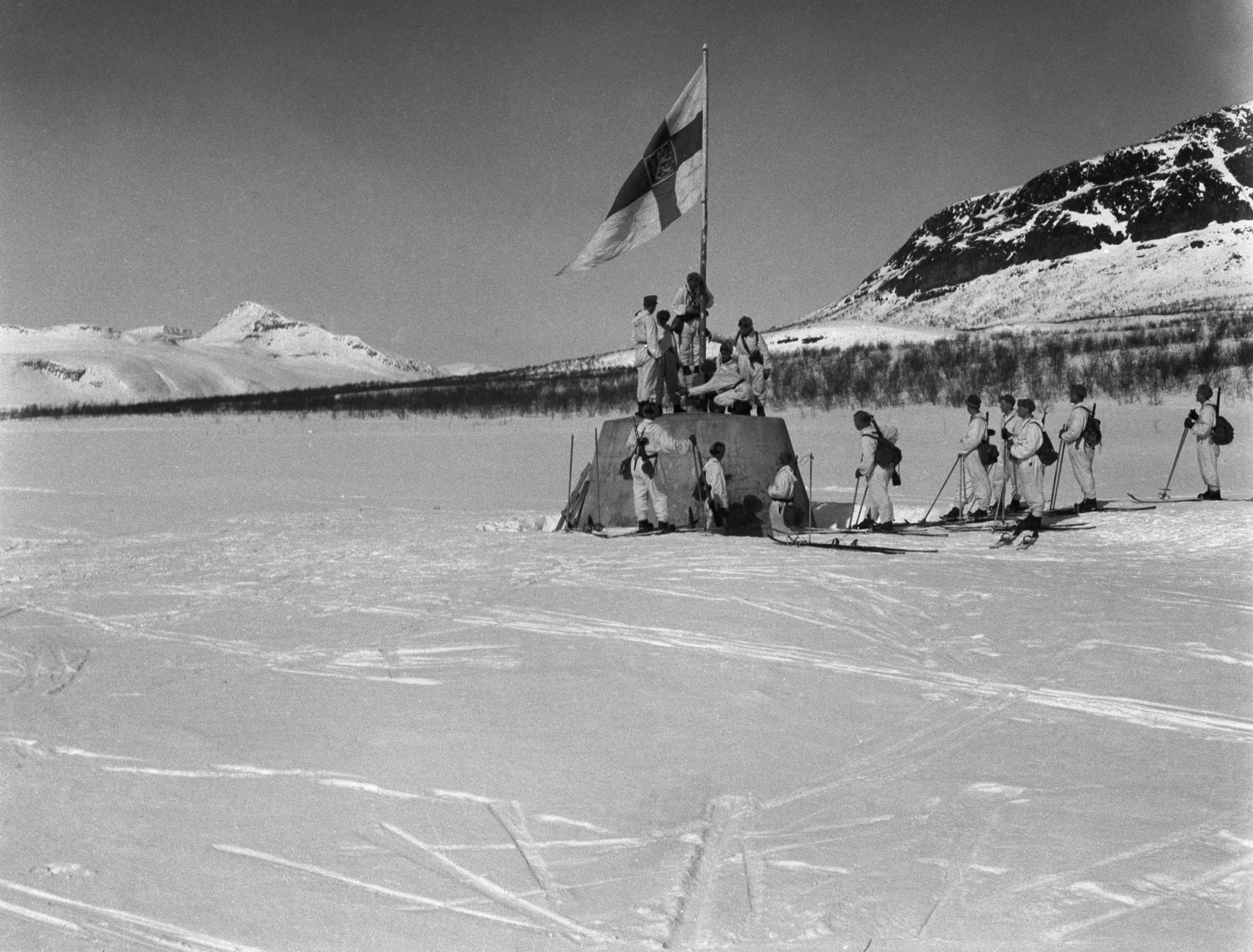_w=1240_h=500.png?v=202509161525) Public domain photo from Wikipedia (courtesy Military Museum of Finland)
Public domain photo from Wikipedia (courtesy Military Museum of Finland)